INDOAVIS CIVIL AIR NAVIGATION MANUAL

(Student Pilot Airnav Manual)

Effective:Februari_2014_(IV/08)

PT. INDOAVIS NUSANTARA, in collaboration with Flying School, create and produce a product, to equip the Instructors and Pilot students with an Air Navigation Handbook domestically produced. This Manual will continually be updated and evaluated in order to generate the will be, reliable and professional Indonesian Aviator Candidates.

- Proposal Student Pilot Manual
- Brochure Product
- Special Cover Request 

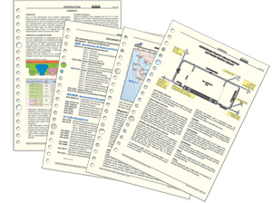
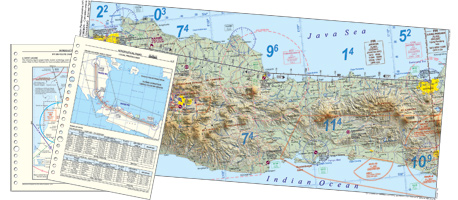
Indoavis Student Pilot Air Navigation Manual, contains information needed by the prospective student pilots and instructors in understanding the information AIS required, in the training of flying and navigation from the beginning of Flight Preparations, Pre-flight, Flight Maneuver Approach / Landing until the parking stage.
The information contained in the Manual has been carefully collected and presented in an easy to understand and use format. The information contained in the Manual, covered at the time of publishing and printing that might be subject to revision and changes that comes with the time.

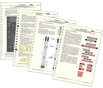
This Manual has been prepared for the use of Student Pilots learning to fly. It provides information and direction in the introduction and performance of Air Navigation Exercises as well as information related to Flight Training Course
In preparing this Manual the Objective was to provide progressive study material, using basic terms and language aligned to Pilot Training at elementary level.
This Manual also provides Introduction to Cross Country Flights both at VFR.

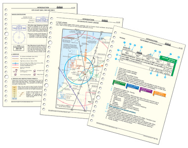
Air Navigation is: The Process of Piloting the Aircraft, from one place to another while monitoring one’s position as the flight progress. It introduce the need for planning, which includes plotting the course on an Aeronautical Chart, selecting check points, measuring distances, observing pertinent weather info and computing flight time, headings and fuel requirements.
The Methods used in the Manual include Pilotage- navigating by references to visible land marks, dead reckoning- computation of direction and distances from a known position, and Radio Navigation by use of Radio Aids.


The  component  content  of  the  information is   grouped  into  two categories as follows:
GENERAL
  1. PREFACE
  2. ACKNOWLEDGEMENTS
  3. INTRODUCTION
  4. FOR CHART ERROR OR FOR CHANGES ADDITIONS
  5. IMPORTANT NOTICE REGARDING AND COPYRIGHT
  6. LETTER OF ACKNOWLEDGEMENT
  7. INTELLECTUAL PROPERTY RIGHT
  8. COMMENT FORM
  9. AIRAC DATE
  10. DOCUMENT REFERENCES
  11. ICAO - CHART FUNCTIONS
  12. AERODROME TRAFFIC CIRCUIT PROFILE
  13. - UNITS MEASURES
II.INTRODUCTION (INT)
  1. CHART GLOSSARY
  2. - ICAO DEFINITION Rules of the Air (Annex 2)
  3. - ICAO DEFINITION Aeronautical Chart (Annex 4)
  4. - ABBREVIATIONS
  5. AIRSPACE
  6. - Airspace Classifications
  7. - Flight Information Region (FIR)
  8. - Special Use Airspace
  9. RADIO COMMUNICATION AND FREQUENCY
  10. - General
  11. - Precautions in the use of call signs
  12. - Student pilot radio identification
  13. - Ground Station call Signs
  14. - Indonesia ground Station
  15. INDOAVIS AERONAUTICAL CHART LEGENDS
  16. - Table of content
  17. - IFR En-Route Chart Legend
  18. - VFR Chart (SAC, ONC and WAC) Legend
  19. - Aerodrome Chart Legend
  20. - Instruments Approach Chart Legend
  21. - SID (Departure) / STAR (Arrival) Chart Legend
III. RECOMMENDED (REC)
  1. AIRPORT SIGNS AND RUNWAY MARKING
  2. - Mandatory Instruction Signs
  3. - Information Signs
  4. - Mandatory Instruction Marking
  5. - Runway Holding Position marking
  6. - Intermediate Holding Position Marking
  7. - Threshold Marking
  8. - Runway Designation Marking
  9. - Runway Centerline Marking
  10. - High Speed taxiway Turn-Off Indicator
  11. - Runway Touchdown Zone Marking
  12. - Runway Aiming Point Marking
  13. - Runway Side Stripe Marking
  14. - Displaced Threshold Markings
  15. - Closed Runways, Taxiways or Parts There of
  16. - Non Load-Bearing Surfaces
  17. - Pre-Threshold Area Marking (Chevron Marking)
  18. AERONAUTICAL GROUND LIGHTING
  19. - Approach and runway lighting typical
  20. - Precision Approach Path Indicator (PAPI)
  21. - Visual Approach Path Indicator (VAPI)
IV.AERONAUTICAL NAVIGATION CHART
  1. INTRODUCTION

  2. USING CURRENT CHART

  3. - Cross Country VFR Route Chart

  4. - Terminal Area Chart

  5. - Flying Training Area Chart

  6. TERMINAL FLIGHT PUBLICATION

  7. - Aerodrome Chart

  8. - Aerodrome Parking/Docking Chart

  9. - Instruments Approach Chart

  10. - SID (Departure) Chart

  11. - STAR (Arrival) Chart


For complete product information regarding coverage’s, services, and pricing, please contact