INDOAVIS CIVIL AIR NAVIGATION MANUAL

(AIRNAV MANUAL)

Effective:Februari_2014_(IV/08)

The need aeronautical information for pilots has become a necessity that can not be separated from their daily tasks. Without complete and accurate information, it is impossible for pilots to carry out their duties perfectly and even flight safety could be disrupted. Therefore to meet the needs of prime requirements, a pilot and/or aircraft should be equipped 
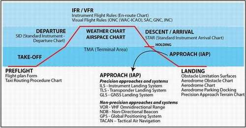
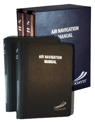
with air navigation manual. It could be argued that INDOAVIS Airnav Manual contains all sorts of information relating to aeronautical information services.

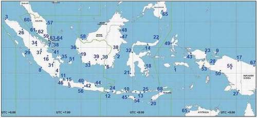
Region informed covers 7 countries: Indonesia, Malaysia, Singapore, Papua New Guinea, Australia, Philippines, Timor Leste. And will always be added according to customer demand (in priority for the airline's operational areas in Indonesia).

Nevertheless INDOAVIS Airnav Manual  has been designed with color map display format according to the rules of cartography. Adjusted numbers and letters large/small the usefulness of such information.

Indoavis AirNav Manual only be used for flight operations by the Crew (Pilot / FOO) rather than as a regulatory document and the provisions of the company. In addition the thickness of two volumes of less than 10 cm, it will not interfere if used by pilots when flying.


In 2010 Aeronautical Information Pack-age consists of 2 (two) books to cover area:

  • INDONESIA (56 Airports) , MALAYSIA (6 Airports) , SINGAPORE (2 Airports), AUSTRALIA (1 Airports), PHILIPPINES (1 Airports), PAPUA NEW GUINEA (1Airports), TIMOR LESTE (1 Airports)

  • List of all Airport ... PDF ( 385 Kb)


The use of "Airnav Manual" has been determined by each state and is required by aviators (pilots) to conduct flight operations from the airport of origin and destination airport, the following described function of every component that must be provided in the operation :

  • PREFLIGHT - TAKE-OFF - DEPARTURE - CRUISING -DESCENT/ARRIVAL - HOLDING - APPROACH PROCEDURE -LANDING - PARKING/DOCKING


The  component  content  of  the  information is   grouped  into  two categories as follows:


GENERAL INFORMATION

TERMINAL PROCEDURE CHART

  • Standard Instrument Arrival Charts

  • Terminal Arrival Altitude Charts

  • Standard Instrument departure Charts

  • Aerodrome Chart / Airport Diagram

  • Instrument Approach Procedure Charts

  • Terminal Area Chart

  • Aerodrome Obstacle Limitation Surface Charts

  • IFR H/L Alt En-route Charts


Coverage areas


The Pilot using Chart


For complete product information regarding coverage’s, services, and pricing, please contact:

Copyright © 1999-2013; Indoavis Nusantara Inc. All Rights Reserved.