INDOAVIS IFR CHART SERIES
IFR EN-ROUTE H/L CHART
Scale 1: 18Nm / 1:3.333.600
Paper Size : 52 x 110 Cm
Edition : 2014
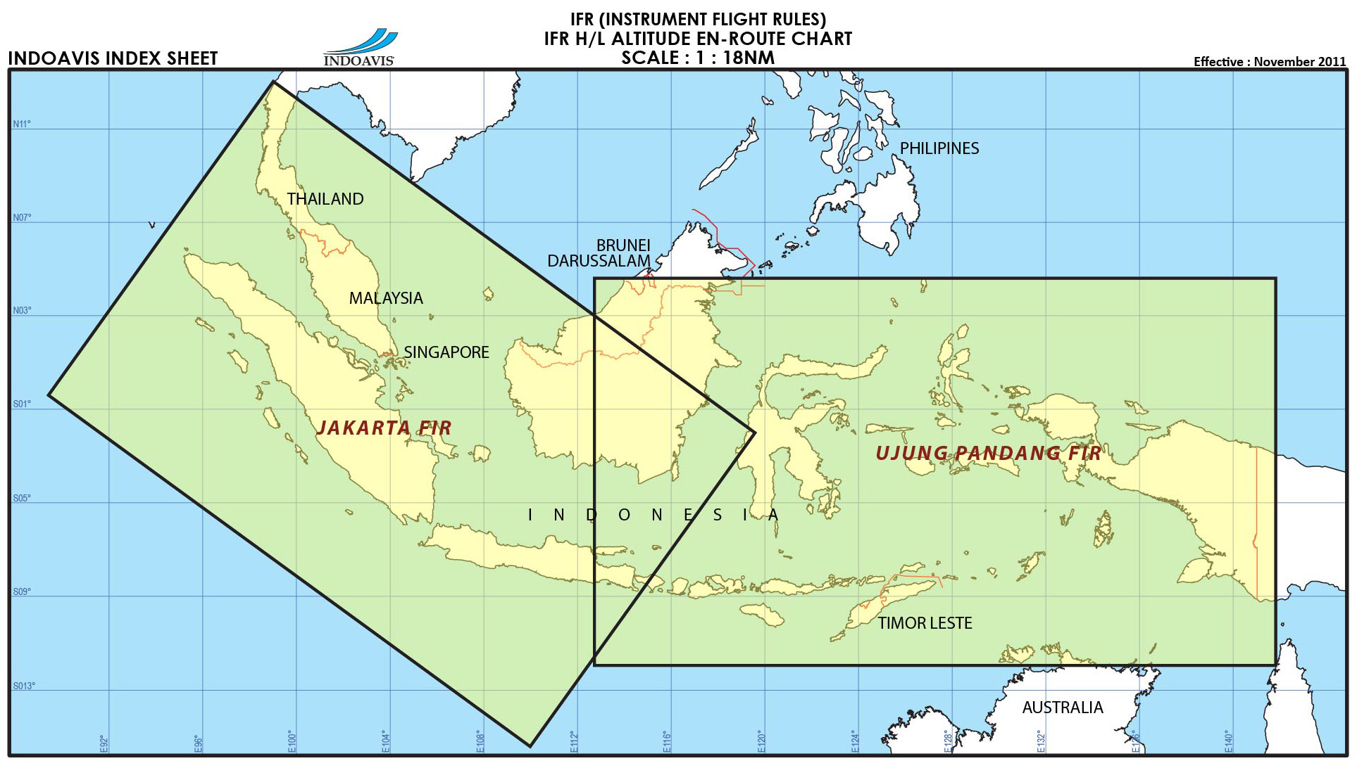
COVERAGE AREA : Indoavis En-Route chart is intended for flight operations in Indonesia with scope covers the territory of Indonesia, divided into two pieces INA1 for the West and INA2 for Eastern Indonesia.
• Sheet INA-1 covers an area of western Indonesia, and parts of Malaysia, Singapore.
• Sheet INA-2 covers an area of western Indonesia, Brunei Darussalam and Timor Leste.
Indoavis IFR HIGH/LOW ALTITUDE ENROUTE CHART are compiled and constructed using the best available aeronautical reference charts. Most Indoavis Enroute Charts use the Mercator projection. The design is intended primarily for airway instrument navigation to be referenced to cockpit instruments. Charts are identified by code letters for Indonesia only areas covered by a series, by parenthetical letters for the altitude coverage, and by numbers for the individual chart. For example, INA-1 / INA2 is a chart of the Indonesia series covering both high and low altitude operations and is number 2 of the series.
Unless otherwise indicated, all bearings and radials are magnetic; enroute distances are in nautical miles; vertical measurements of elevation are in feet above mean sea level; enroute altitudes are either in feet above mean sea level (based on QNH altimeter setting) or clearly expressed as flight levels (FL).
Most En-route and Area Chart mileages are represented on the plotter. Check the top margin of the chart in use for the correct scale. All chart scales, and all plotter scales, are in nautical miles. Indoavis Enroute chart scale is 1Cm = 18Nm
INFORMATION CONTENT
1. Limit and Clarification of Designated Upper Airspace.
2. Airspace structure and Airspace Restricted Areas
3. Aerodrome point
4. Cruising Levels, Navigation Aids
6. Radio Communication Frequencies within indonesia
7. International and Domestic Route.
8. Bearing and Distance to point
9. FIS frequencies
Index Indonesia Sheet coverage

EN-ROUTE BROCHURE
