INDOAVIS VFR CHART SERIES
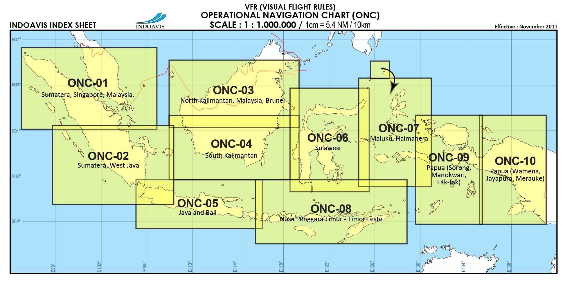
Scale 1:1.000.000 1cm = 5.4 NM / 10 KM
VFR (Visual Flight Rules)
Paper Size : Variables
Edition : 2014
Coverage Areas : Indonesia, Malaysia, Singapore, Brunei Darussalam and Timor Leste.

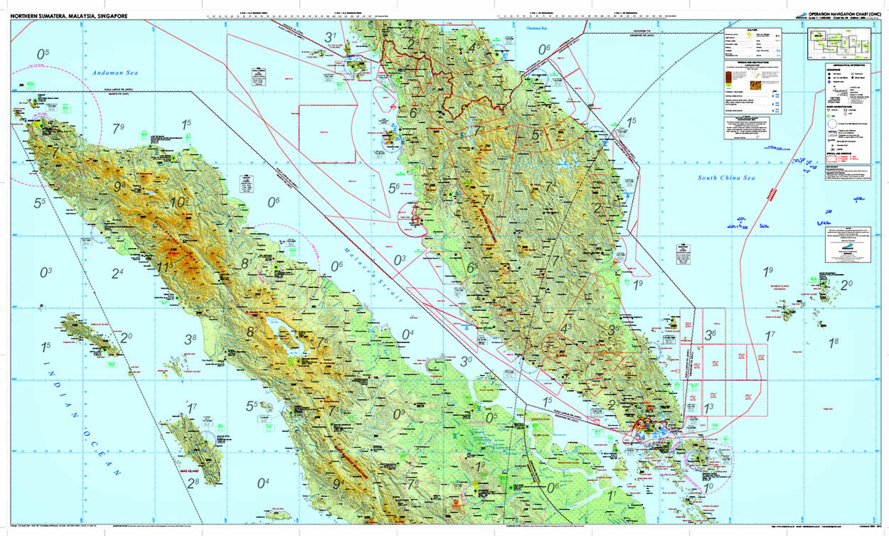
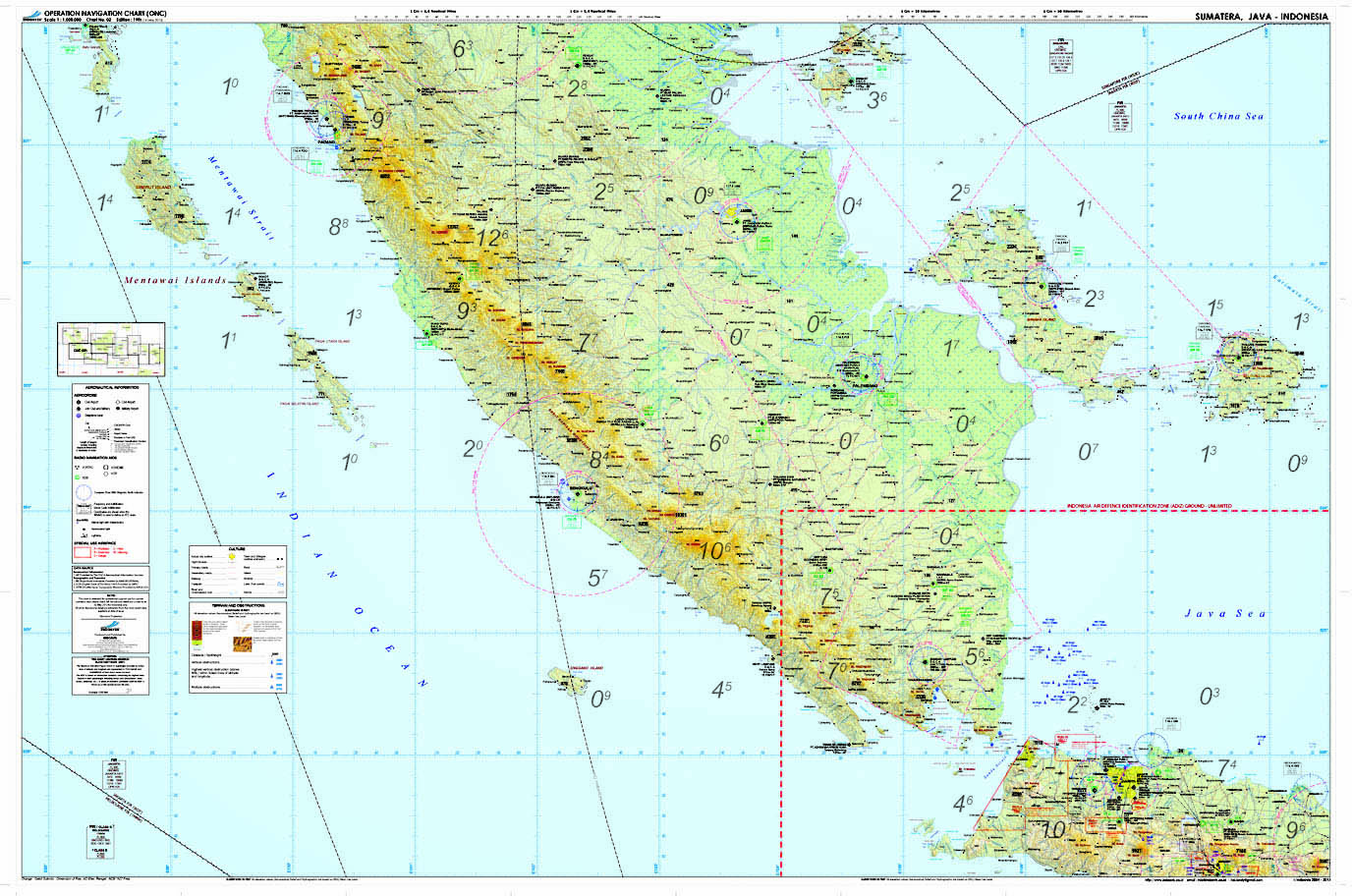
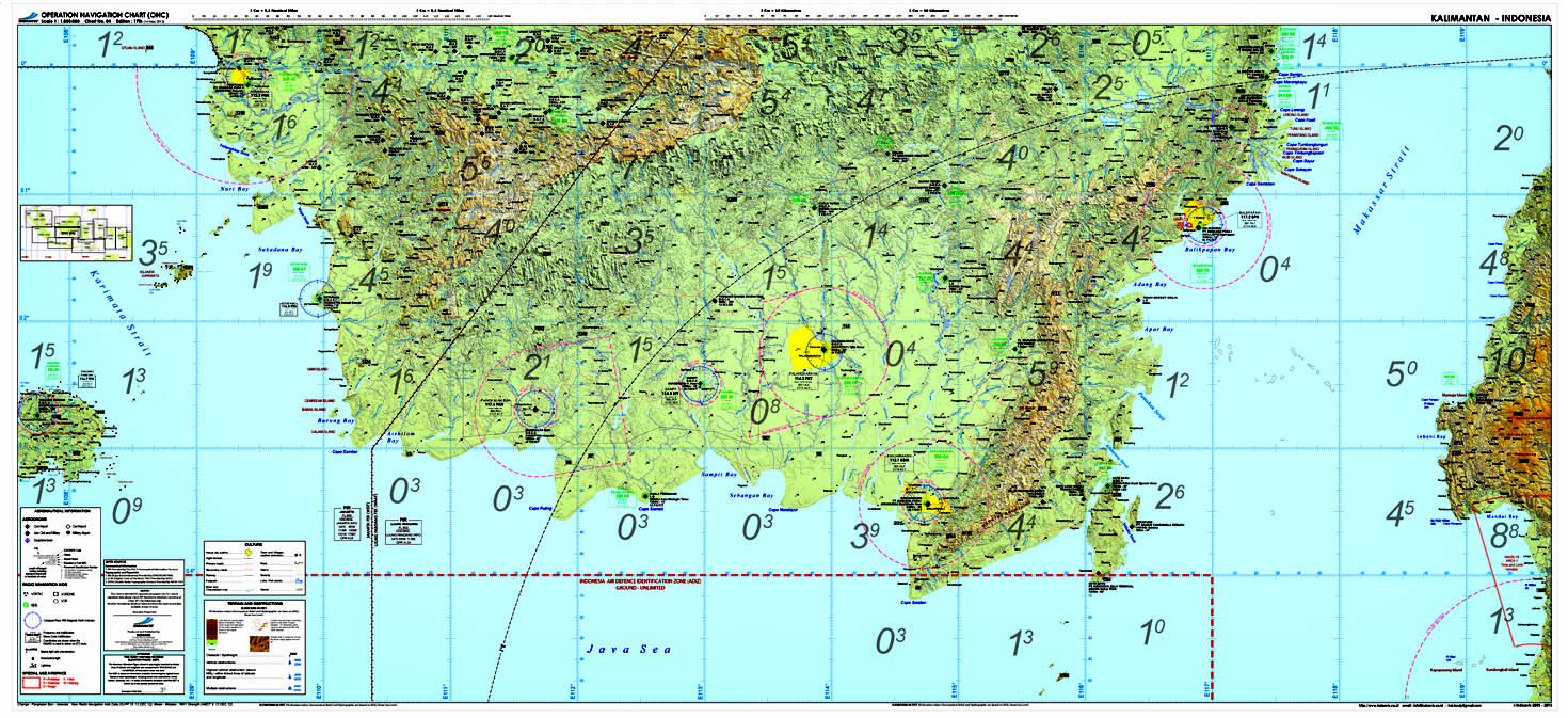
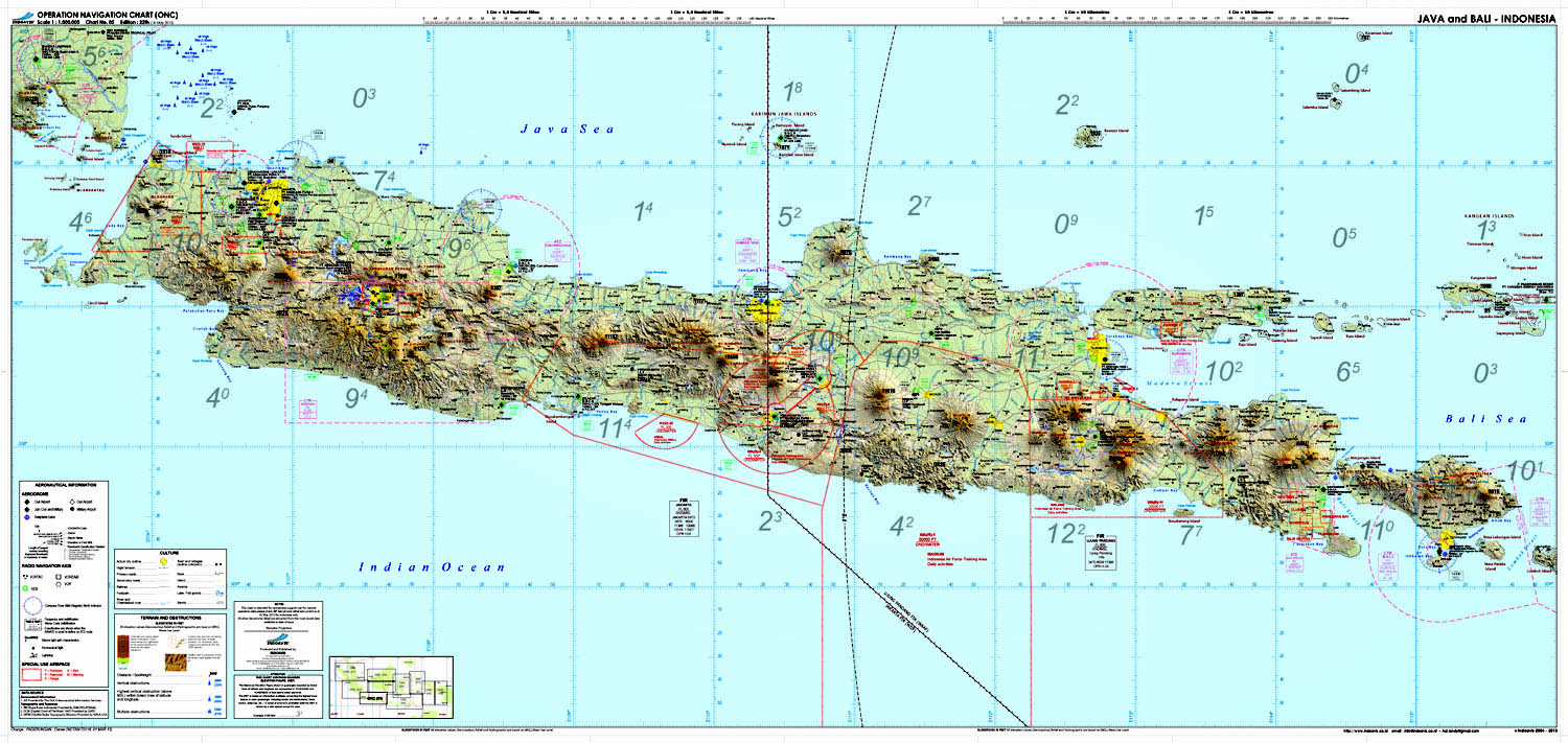
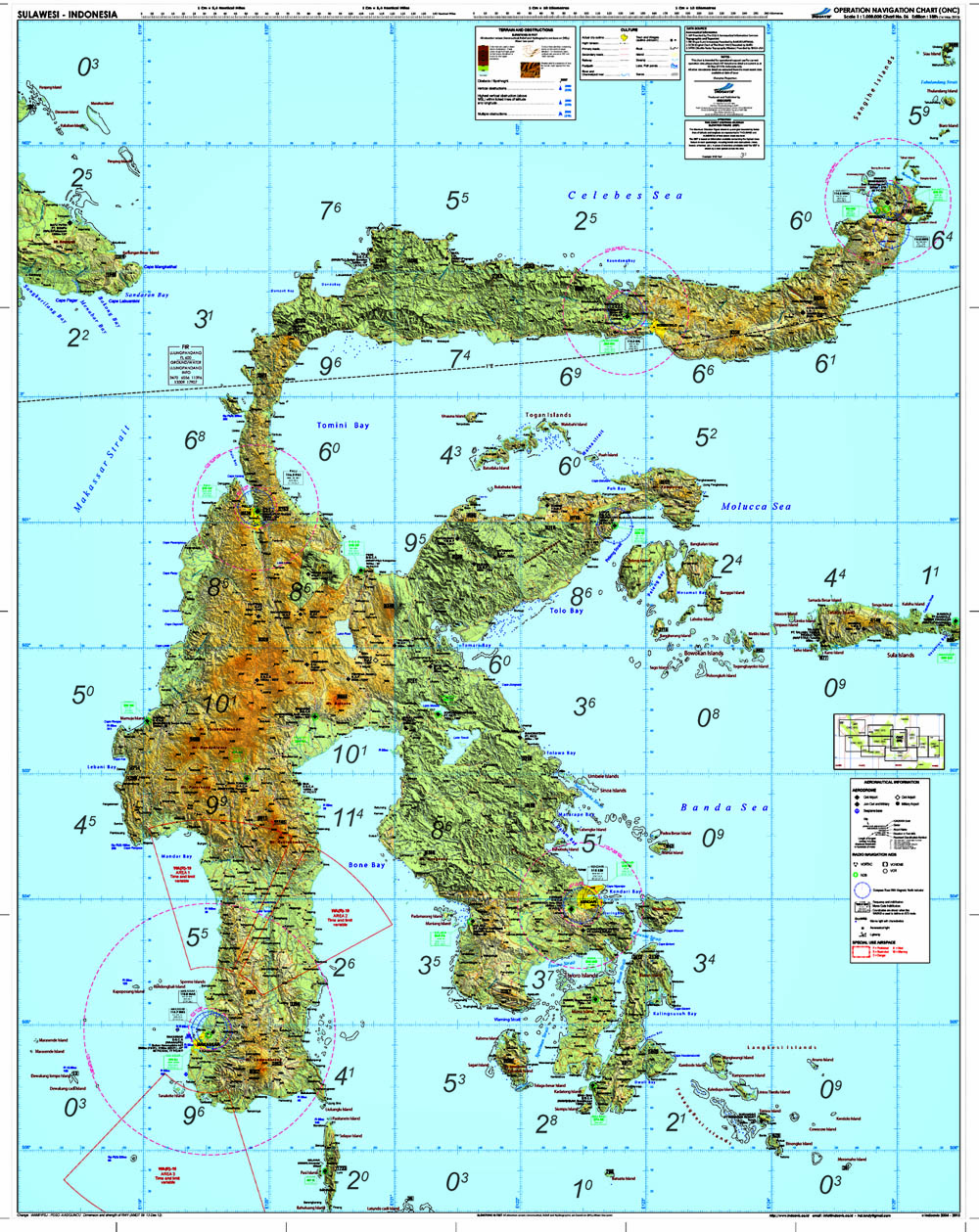
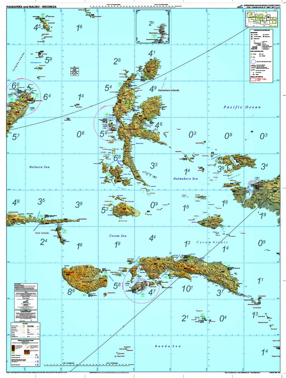
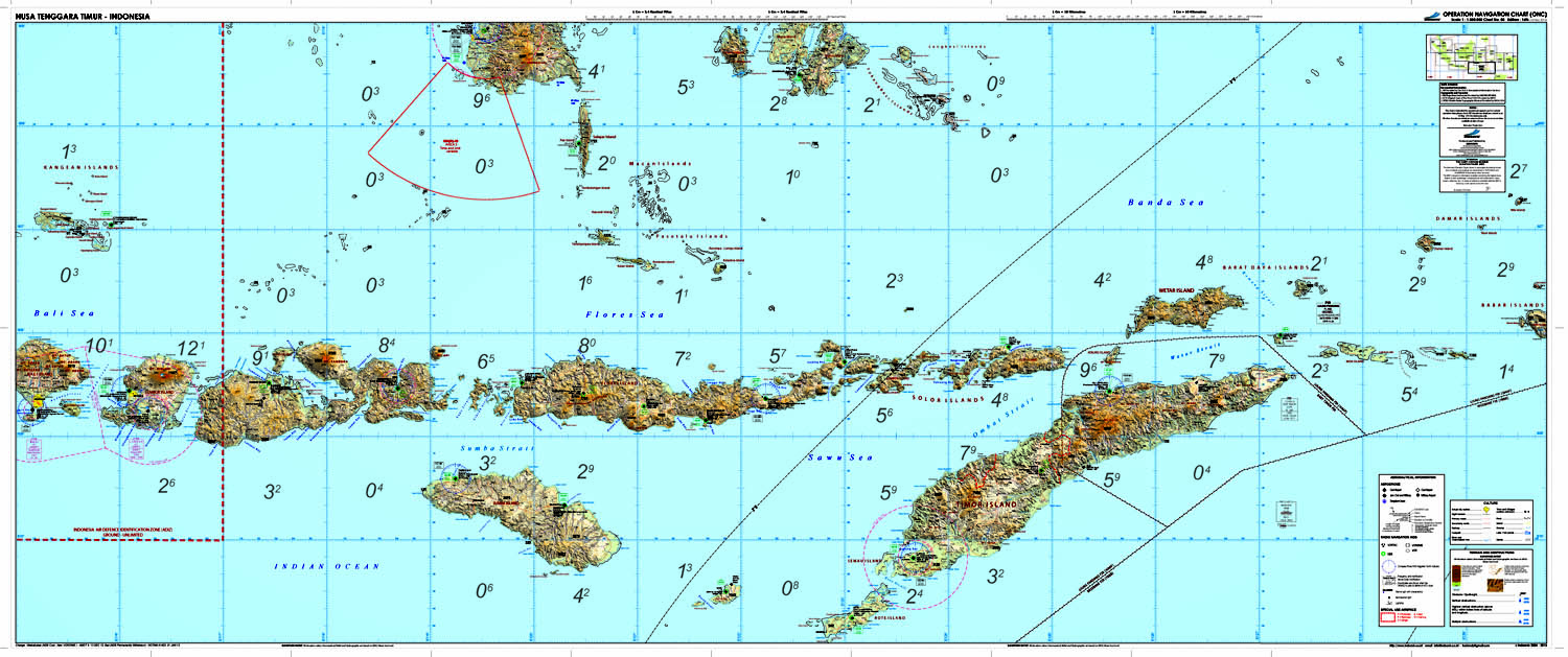
Operational Navigation Charts (ONCs) are a series of worldwide small-scale (1:1,000,000) aeronautical charts that provide topographic information for air navigation. They are designed for medium-altitude, high-speed visual and radar navigation and are also used for operational planning and intelligence briefings.
They were used in 1992 as the basis of a Digital Chart of the World, a comprehensive vector base map of the world sponsored by the U.S. Defense Mapping Agency (now the U.S. National Imagery and Mapping Agency).
ONCs are aeronautical charts produced by Indoavis Nusantara for use as en-route medium-altitude (2,000 to 25,000 feet) navigational aids. They show elevation, topography, cultural features, and hydrography. ONCs were integrated with two other independent digital sources--vegetation maps following the UNESCO system (Matthews, 1983) and FAO maps of soil properties (Zobler, 1986)--to produce a high-resolution global database for evaluating natural wetlands and their methane emissions. The ONCs provided fractional inundation data from 1-degree cells of a global map survey and were the most up-to-date and consistent of the three sources. Aerial photography is the fundamental mapping tool, and the large scale of the series provides the potential for representing more realistic detail than do most of the smaller-scale sources used in compiling the other two databases.
AERONAUTICAL DATA INFORMATION
- Controlled and Non Controlled Airport
- Radio Navigation Aids
- Airspace and Special Airspace
- Low Altitude Route
TOPOGRAPHY DATA SOURCE
-SRTM (Shuttle Radar Topography Mission) NASA
-DCW (Digital Chart of the Word) NASA
-RBI (Rupa Bumi Indonesia) Bakosurtanal/BIG
-Basic background political map is from digital chart of the world and Batas