Product CODE : AIRNAV MNL
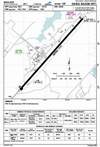
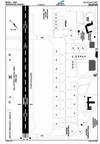
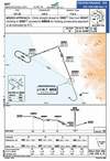
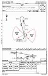
Provides an illustration of the aerodrome/heliport which allows the pilot to
recognize significant features, rapidly clear the runway touchdown area after landing. The charts show aerodrome/heliport areas, visual indicator locations,
lighting, hangars, terminal buildings, various reference points required
for the setting and checking of navigation systems and operational information such as pavement strengths and radio
communication facility frequencies...
detail
Product CODE : IFR-HL-WALL
Chart Scale : 1Cm:18Nm - 1"=46Nm
Effective : 13 June 2008
Aeronautical Update : Every 28Day (AIRAC)
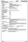
Published By INDOAVIS
see detail chart
Aeronautical Update : Every 28Day (AIRAC)
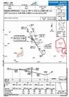
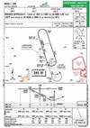
Product CODE : AIRNAV MNL
The text show aerodrome/heliport movement areas, visual indicator locations, taxiing guidance aids, lighting, hangars, terminal buildings and aircraft/heliport stands, various reference points required for the setting and checking of navigation systems and operational information such as pavement strengths and radio communication facility frequencies.
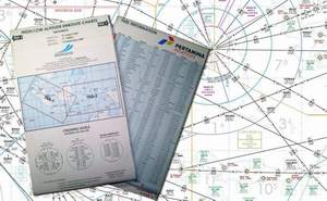
Chart Scale : 1Cm:18Nm - 1"=46Nm
Effective : 13 June 2008
Sponsor By : Pertamina Aviation
Aeronautical Update : Every 90 Day (AIRAC)

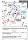
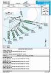
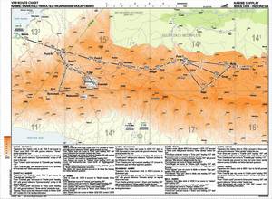
(STAR) Charts are designed to expedite ATC arrival procedures and to facilitate transition between enroute and instrument approach operations. They present the pilot a pre planned IFR ATC arrival procedure in graphic and textual form. Each STAR procedure is presented as a separate chart and may serve a single airport or more than one airport in a given geographic location. To accept a STAR, you must have at least a textual description.
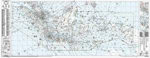
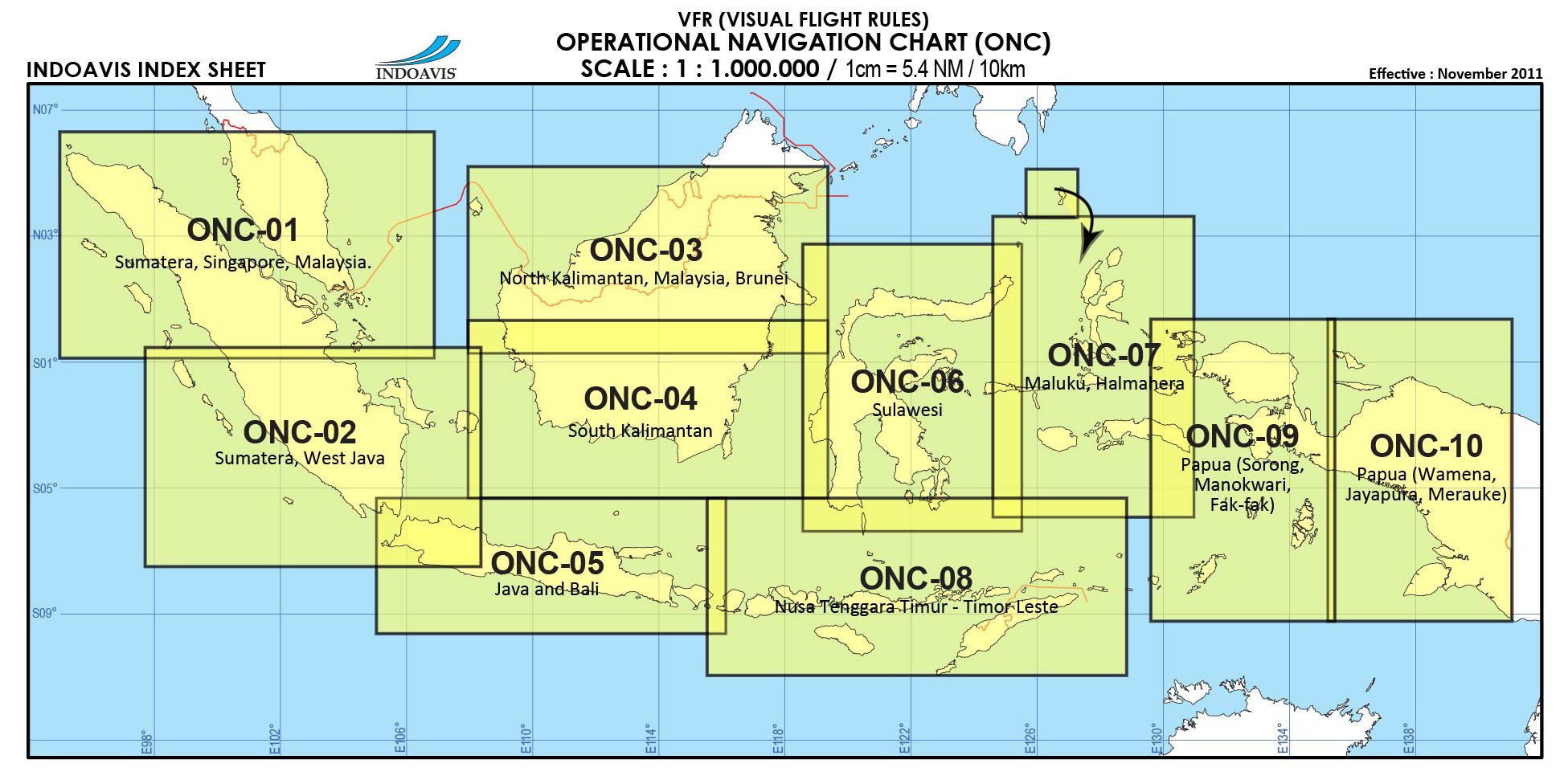
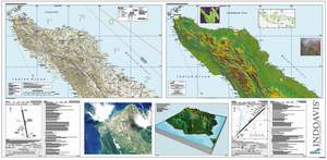
OPERATION PLANNING NAVIGATION CHART (ONC-WALL)
Product CODE : VFR-ONC-WALL
Published By INDOAVIS
Effective : 10 May 2012
Aeronautical Update : Every 3 mount
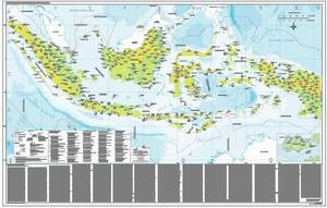
The ONC WALL is the standard worldwide small- scale (1: 1,000,000) aeronautical chart, and contains cartographic data with an aeronautical overprint depicting obstructions, aerodromes, special use airspace, navigational aides, Maximum Elevation Figures (MEFs), and related data. Because of scale, some features, including obstructions, are generalized in developed regions. A Military Grid is overprinted for interoperability, especially in regions of no TPC coverage. Designed for medium altitude high- speed visual and radar navigation. Also used for mission planning/ analysis and intelligence briefings.
Aeronautical Update : Every 28Day (by AIRAC)
Product CODE : AIRNAV MNL
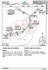
(SID), now referred to as Departure Procedures (DPs), are published to expedite clearance delivery and to facilitate transition between takeoff and enroute operations. The SID provides a standard route from the terminal to the enroute structure. There are often transitions which connect the end of the SID with one of several enroute possibilities.
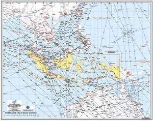
OPERATION NAVIGATION CHART
Product CODE :
VFR-ONC-SPL
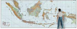
These
1:1,000,000 ONC charts provide additional uniform Indonesia only
coverage for areas within and outside the VFR + GPS series. They
were originally developed use and provide aeronautical information
relating to the positions of aerodromes (major and minor),
obstacles, offshore installations, radio navigation aids and
aeronautical lights etc. Maximum elevation figures are boldly
marked.
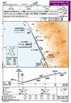
LANDING SYSTEM APPROACH CHART
Published By INDOAVIS
Aeronautical
Update : Every 28Day (by AIRAC)
Product CODE :
AIRNAV MNL
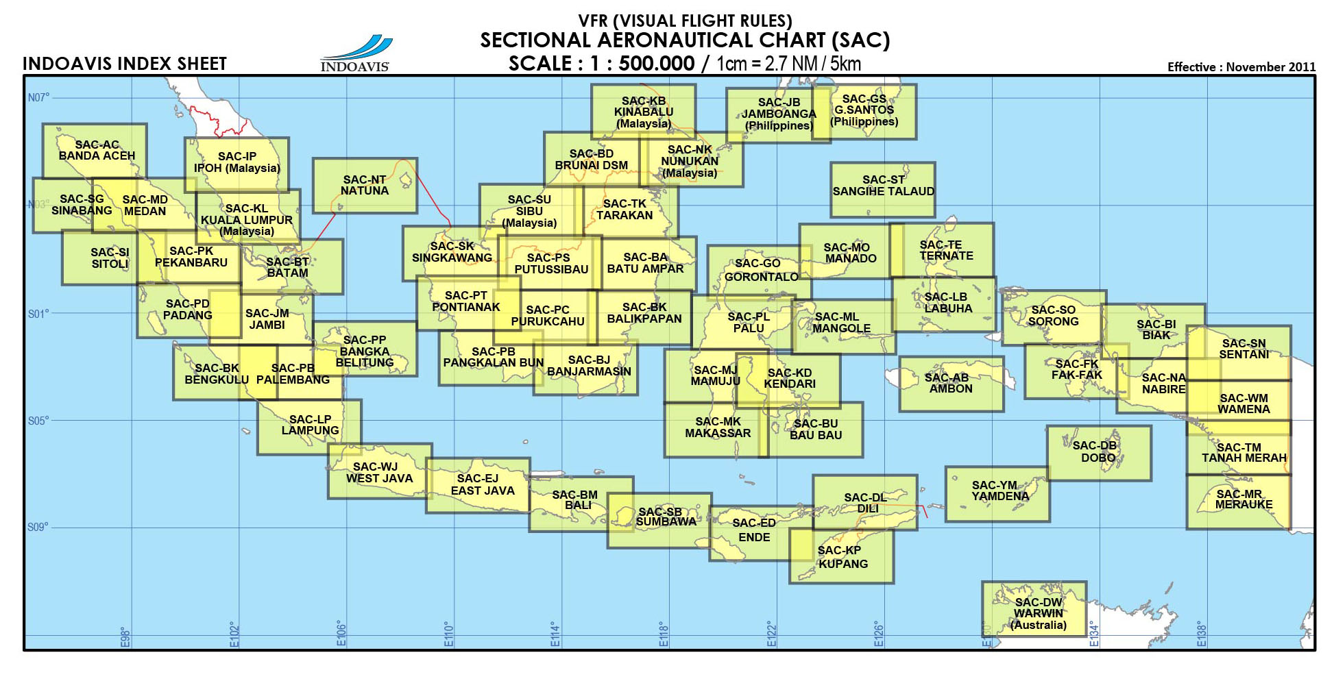
Product CODE : VFR-SAC
Published By INDOAVIS
Effective : 01 February 2010
Aeronautical Update : Every 2 mount
Product CODE : AIRNAV MNL
Provides the pilot with a graphic presentation of instrument (VOR/DME) approach procedures, and missed approach procedures to be followed should the crew be unable to carry out a landing.
NDB APPROACH CHART
Published By INDOAVIS
Aeronautical
Update : Every 28Day (by AIRAC)
Product CODE :
AIRNAV MNL
HELICOPTER APPROACH CHART
Published By INDOAVIS
Aeronautical Update : Special Order
Product CODE :IAP HELI
Aeronautical Update : Special Order